Sales & Marketing
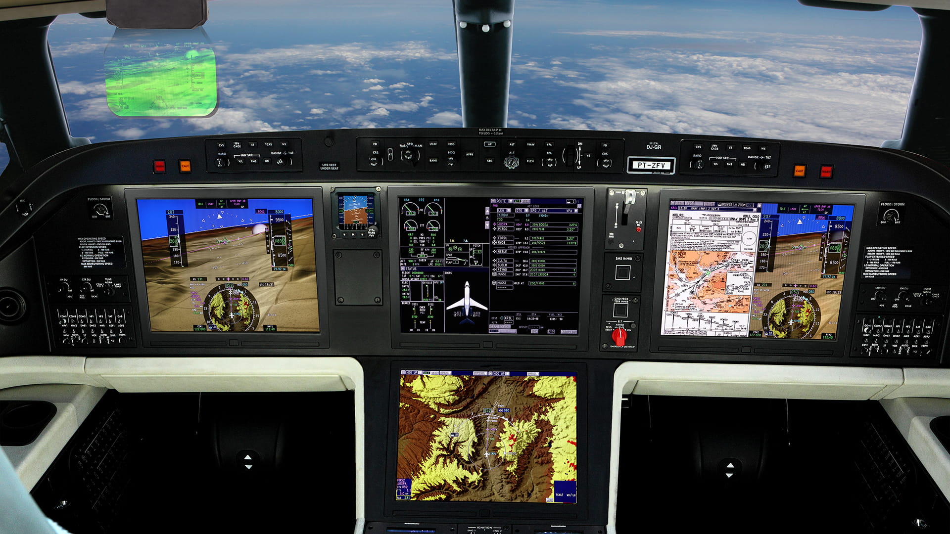
Your Pro Line Fusion® flight deck provides a broad range of baseline capabilities that maximize the efficiency and effectiveness of every flight. It offers an empowering human interface, extensive situation awareness, flexible and adaptable integration and information-enabled design. Plus, your Pro Line Fusion avionics system is ready for powerful options that can take your aircraft into NextGen® and beyond.
Powerful baseline features
- Four 15-inch liquid crystal displays – largest in the industry
- Synthetic Vision System
- Configurable split-screen formats
- Dual VHF communications
- Dual Global Navigation Satellite System
- Dual advanced flight management systems
- WAAS LPV capability and RNP capabilities
- Automated database management (AIM)
- Integrated Flight Information System (IFIS)
- Electronic charts
- Enhanced map overlays
- Document reader
- MultiScan™ weather radar
- Integrated traffic surveillance system
- Terrain Awareness Warning System
- Information Management System – Wi-Fi® and cellular
- On-board maintenance system
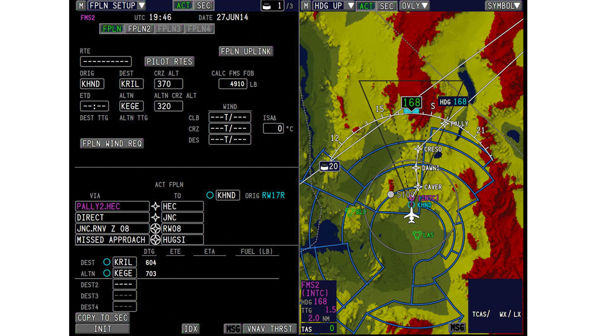
- Graphical flight planning
- Full-flight regime autothrottle
- Graphical aircraft system synoptics
- Electronic checklists integrated with crew alerting system
- High-resolution terrain maps with overlays
- Vertical Situation Display
- Integrated ATC data link and graphical weather
Synthetic Vision System (SVS)
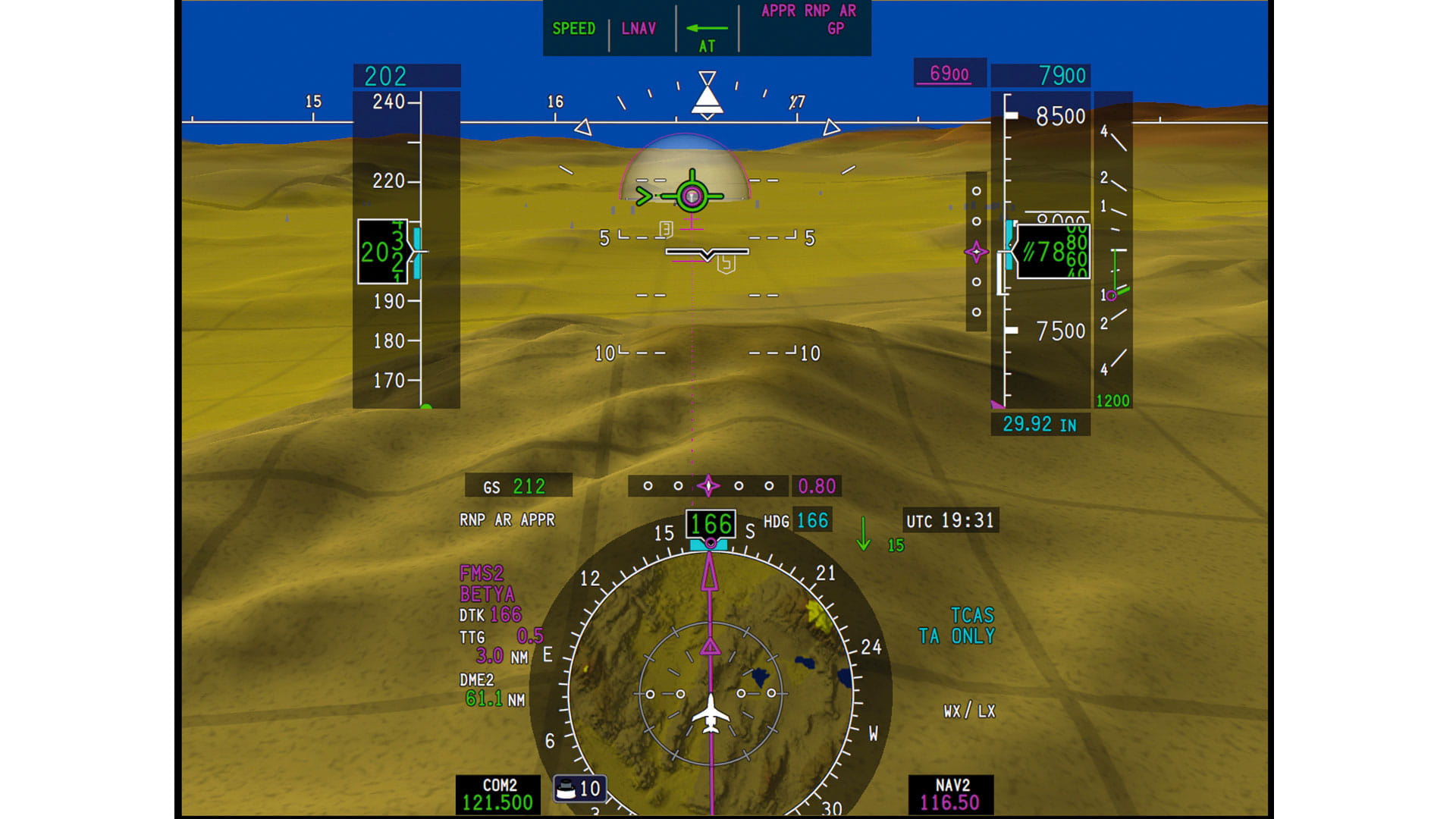
Equipped with SVS, you gain better situational awareness in low visibility conditions and unfamiliar territory. The system integrates the terrain database with real-time flight information, allowing flight crews to operate like it's always a VFR day.
One Complete View
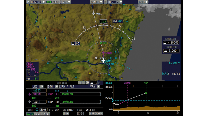
Easily create and modify flight plans graphically through the use of interactive map symbols displayed directly on the large moving map. Built-in top-down and side profiles of terrain are another safety enhancement to reduce the risk of controlled flight into terrain, or CFIT, by providing one complete view.
Electronic Chart View
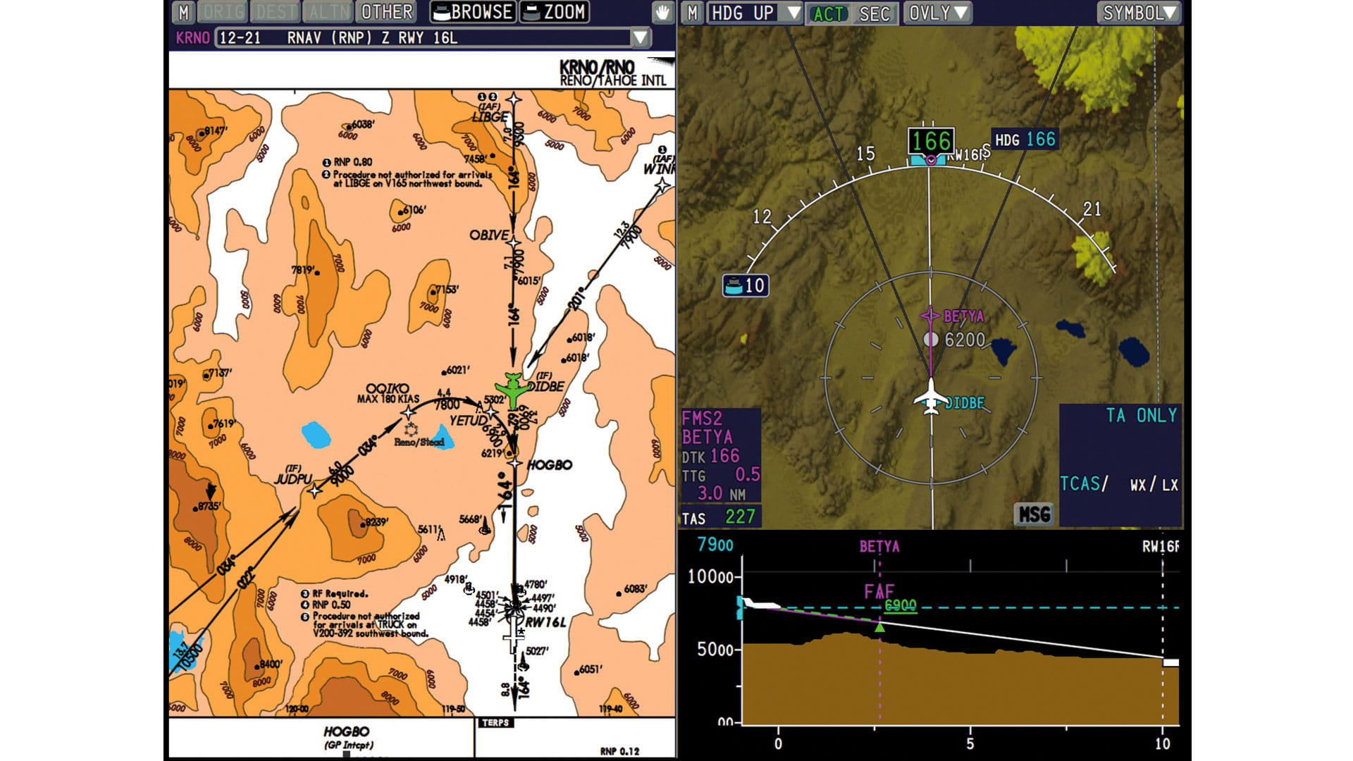
Real-time access to a virtually endless array of information integrated in easy-to-understand formats. Previously, this information was only accessible from multiple sources. Approach plates, en-route charts, graphical weather and manuals are consolidated in one location, with one consistent look and feel.
Smart Checklists/Synoptics
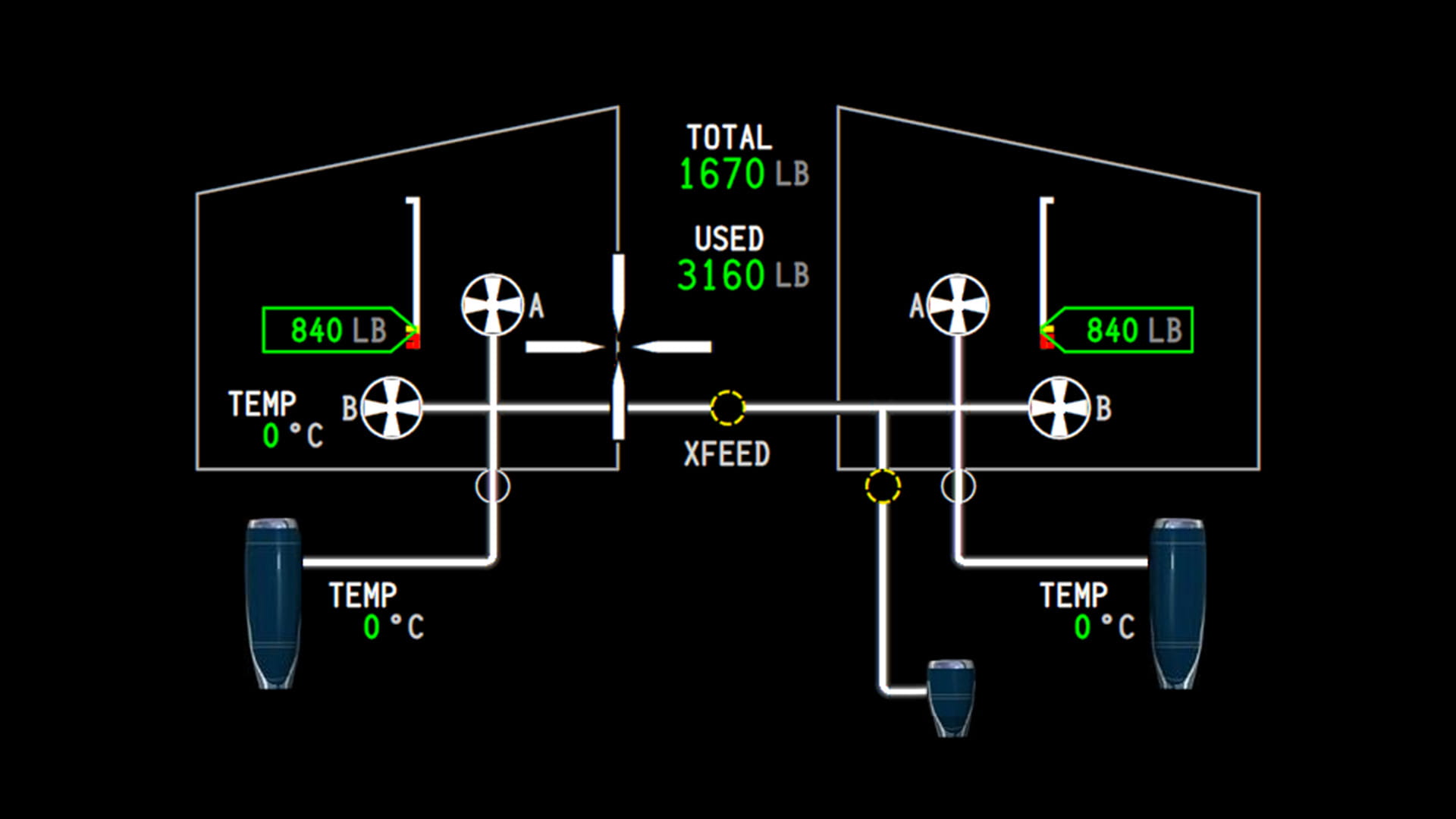
Streamline the monitoring of your aircraft system data. Electronic smart checklists allow you to easily step through normal and emergency procedures. Added EICAS sensing links checklists and synoptic together, enabling your crew to quickly assess the current aircraft state.
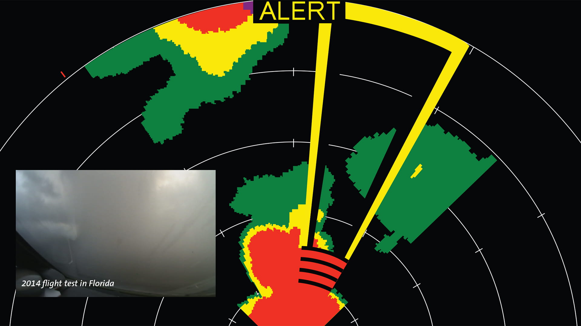
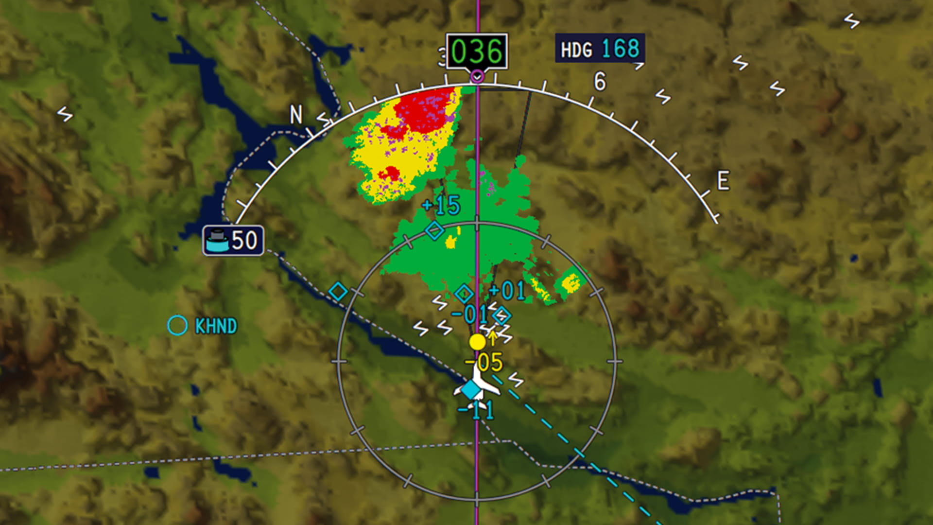
MultiScan Weather Radar
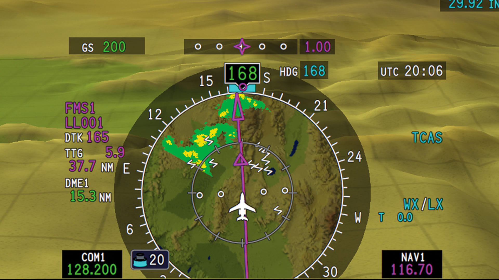
You can't control bad weather, but you can avoid it with full-color storm cell tracking that is automatic and clutter-free, scanning 320 nautical miles ahead of your aircraft. OverFlight™ protection mitigates the risk of inadvertently penetrating thunderstorm tops.
Pro Line Fusion avionics options for Embraer Legacy 450 and 500
Cutting-Edge Technology at the Highest Resolution and Accuracy
As an Embraer Legacy owner or operator, you already know that your aircraft’s flight deck features the cutting-edge technology of Pro Line Fusion avionics. Its capabilities can make flying safer, more efficient and more enjoyable than ever.
But what you may not know is that your Pro Line Fusion flight deck is already primed for a broad spectrum of options that can position your aircraft to meet the demands – and unlock the advantages – of operating in NextGen airspace.
Pro Line Fusion avionics options – because when it comes to your Legacy, best equipped is best served.
Key options
- Head-up Guidance System (HGS™)
- Enhanced Vision System (EVS)
- FANS
- Predictive wind shear
- Automatic Dependent Surveillance-Broadcast (ADS-B) Out
- Link 2000+ and Controller-Pilot Data-Link Communications (CPDLC)
- Surface Management System: Airport moving map, takeoff and landing alerts
- Paperless operation
- High frequency (HF)/SELCAL
- XM™ WX Satellite Weather® and data-link graphical weather
- RNP AR 0.3
- Second autothrottle
- Lightning detection
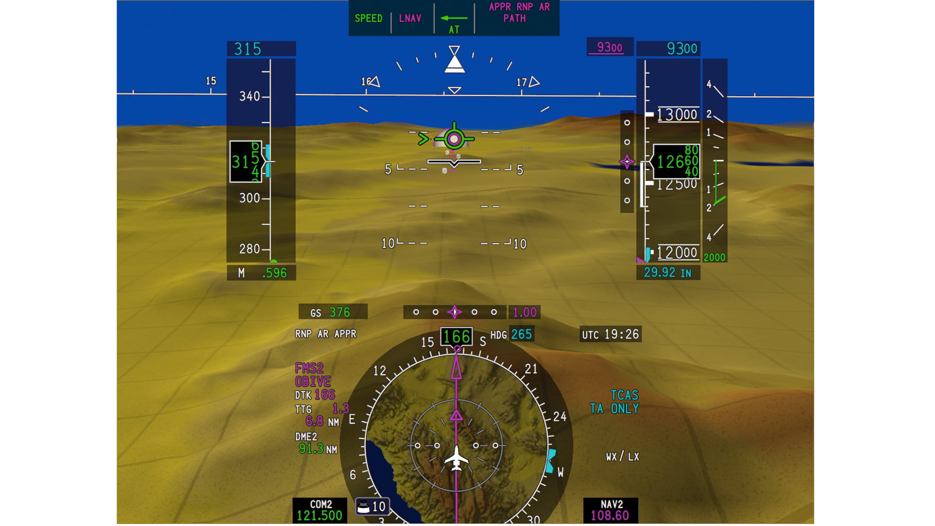
Head-up Guidance System (HGS™)
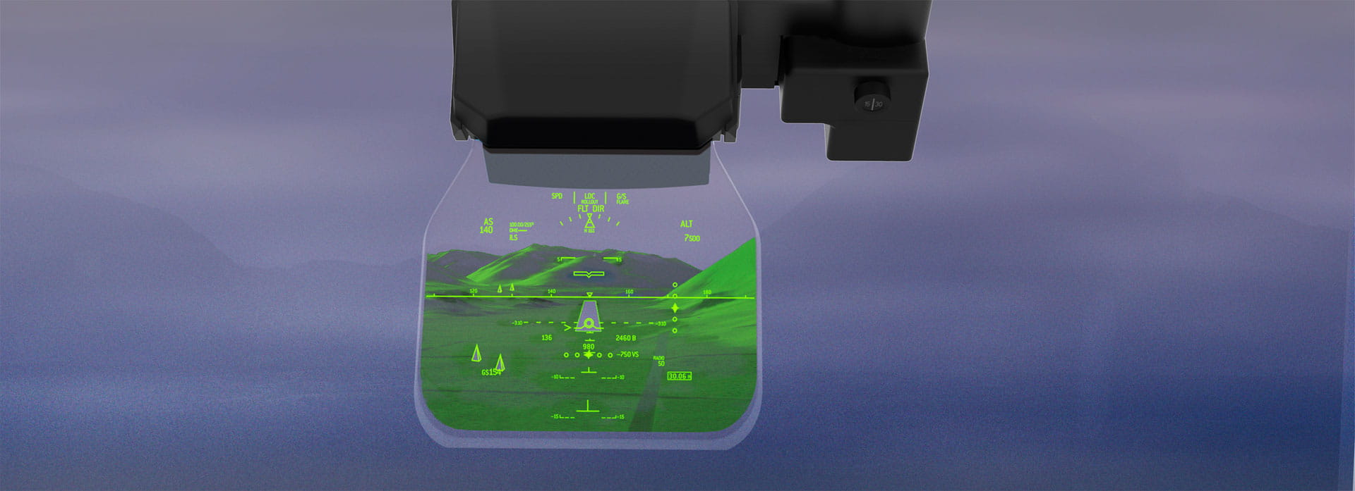
Fly eyes forward
Mitigate unstable approaches by having critical flight information in pilots’ forward field of view. Gain greater flight path awareness and safety while also accessing the lower landing minima available only with head-up displays. Equip to take advantage of NextGen airspace and anticipated Enhanced Flight Vision System rule changes. All in a new, compact design that delivers spacious headroom on the flight deck.
- Enables use of SA CAT I approval and Enhanced Flight Vision System CAT I lower landing minima.
- Displays aircraft’s current position, speed and altitude, plus projected flight path. Assists in maintaining stabilized approaches.
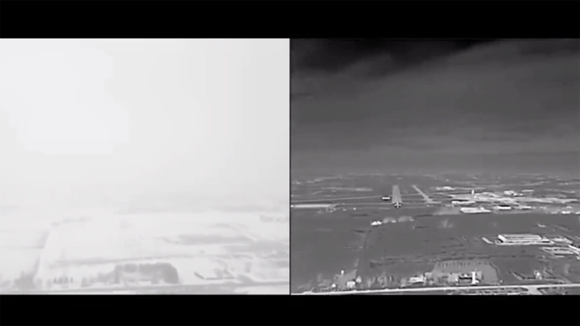
Enhanced Vision System (EVS)
Make a "Go/No Go" decision with confidence. In low-visibility conditions, gain real-time awareness of terrain or real-time obstacles in your aircraft’s flight path. A solution that brings an industry first: the ability to detect the latest LED airport lighting in a compact, lightweight and reliable package that requires no cooling.
No Go (left side): Execute a missed approach. CAT 1 approach view through windscreen.
Go (right side): With EVS on HGS, descend to 100 feet before going visual if the runway environment is in sight at 200 feet. Same CAT 1 approach view with multi-spectral EVS on HGS.
FANS 1/A

Flying the North Atlantic tracks? The 2020 mandate is fast approaching. Maintain your access to preferred routes with FANS 1/A, whether it's using the preferred tracks heading to Europe or expediting your departure at the 56 Data Comm (DCL) enabled airports in the United States.
Predictive Wind Shear
Know when wind shear is ahead. An enhanced feature of MultiScan weather radar provides you with visual and aural cautions before wind shear becomes an immediate threat. Allows time for corrective action.
Automatic Dependent Surveillance-Broadcast (ADS-B) Out
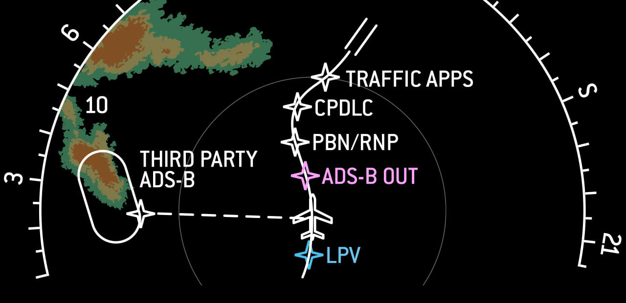
Maintain your aircraft's value while complying with upcoming ADS-B Out mandates with an option that delivers real-time traffic and aeronautical information to your flight deck. This airspace modernization mandate goes into effect in the U.S. at 11:59 p.m., December 31, 2019.
- Reduces separation and increases predictability in departure/arrival times
- Improves traffic awareness, safety and efficiency in congested airspace
ATN (Link 2000+)
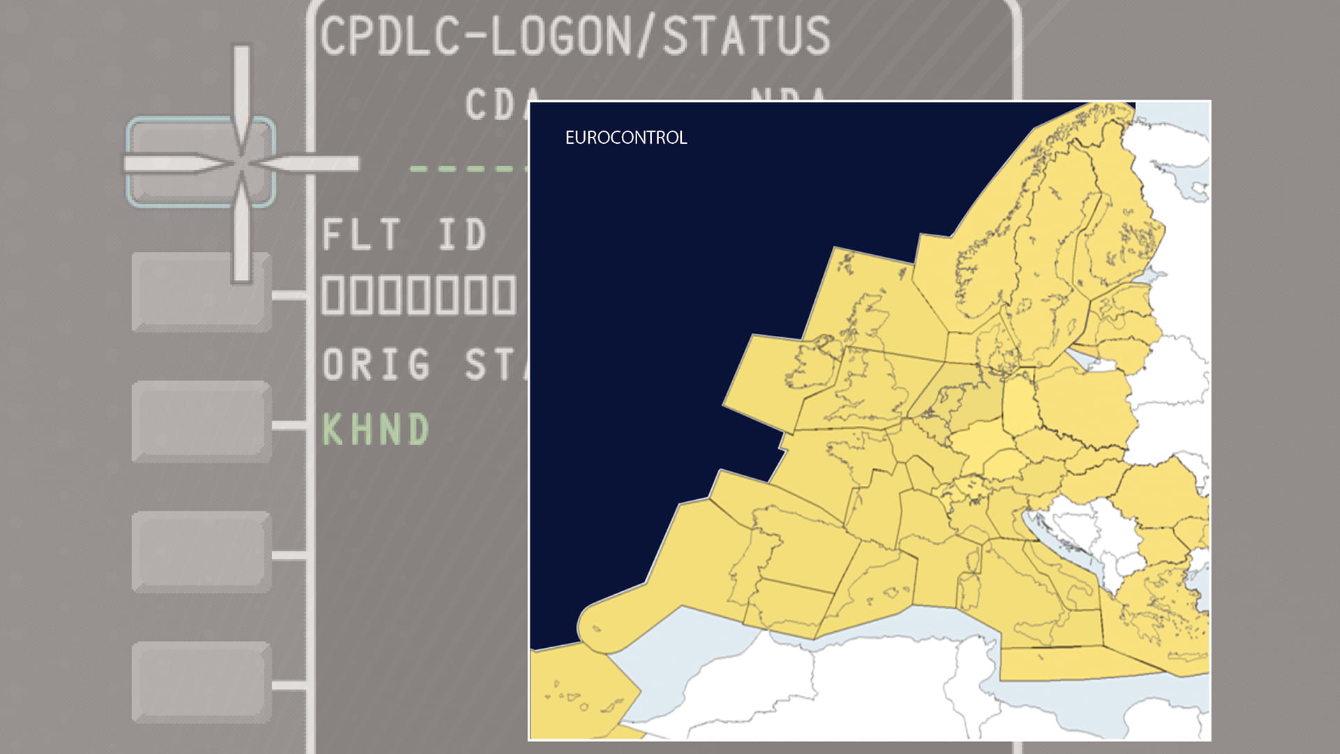
Based in Europe or traveling to your favorite European destination soon? Equip to maintain access to all your favorite European destinations with confidence. The Aeronautical Telecommunication Network (ATN) data-link channel enables a more reliable and easier means of communication between pilots and busy air traffic controllers.
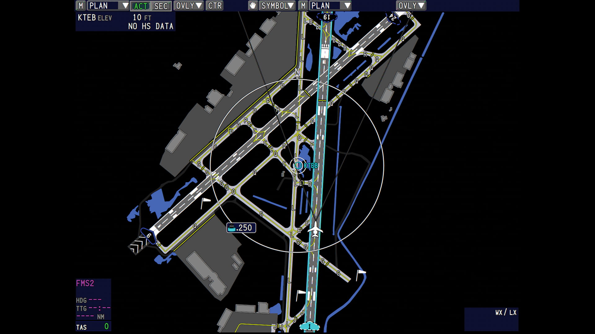
Surface Management System
One-third of all aviation accidents have been linked to runway operations. Reduce the risks of runway incursion and confusion with our Airport Moving Map and aural and visual takeoff and landing alerts. These innovative tools maximize pilot situational awareness when approaching, departing or taxiing at complex or unfamiliar airports.
Paperless Operation
Don’t let a low battery light on your mobile device be the reason you can’t reach dispatch. Simplify flight deck operations and reduce distractions with an integrated solution for approach plates, en route charts, documents or manuals, requiring no separate mobile device to carry on board.
Graphical Weather
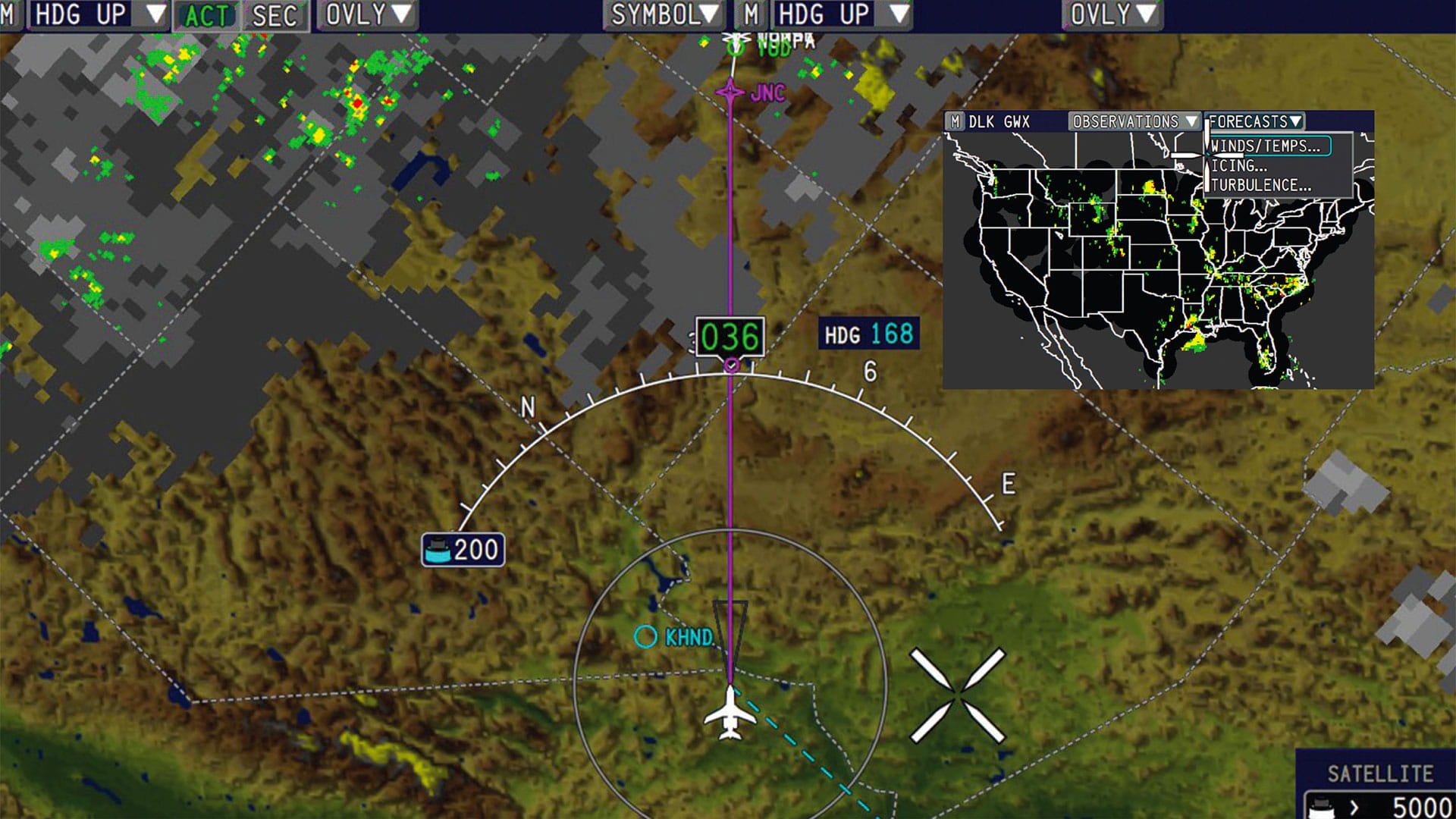
Expand your weather knowledge out to 1,000 nautical miles. Two solutions overlay the navigational map for seamless decision making.
- XM™ graphical weather
- High-resolution strategic weather with updated awareness of changing weather patterns in the continental United States.
- Data-link graphical weather
- Worldwide forecast and observations for a strategic weather view.
RNP AR 0.3
Unlock access to 400+ additional approach landing minima. Equip your aircraft with Performance Based Navigation (PBN) for easier access to heavily congested or terrain-challenged airports. You'll take advantage of shorter approach routing and lower landing minima to maximize fuel savings.
Lightning Detection
Know where storms are developing in real time. Color-coded symbols display lightning activity around your aircraft, assisting pilots in determining the best routing to avoid convective weather.
Contacts
Support