
The Collins Aerospace ARINCDirectSM flight planning solution leverages the power of today’s most advanced analytics and technologies to quickly and easily analyze flight data. These technologies put the power to rapidly identify the most efficient, most sustainable, and safest routes and flight paths at the fingertips of flight crews and business aviation operators.
Whether it’s navigating dangerous and unpredictable weather systems or global airspace restrictions, ARINCDirect delivers powerful flight planning capabilities directly to a pilot’s mobile device.
Native integrations with FlightAware ensure all stakeholders can access the latest, most accurate, real-time data and intelligence, enabling more informed, data-driven flight path decisions.
ARINCDirect: Simple, smarter flight planning at your fingertips
The Collins Aerospace ARINCDirectSM flight planning solution puts the power to rapidly identify the most efficient, most sustainable, and safest routes and flight paths at the fingertips of flight crews and business aviation operators.

The interface
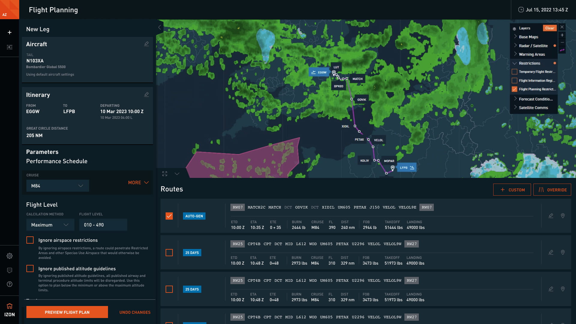
Our simple, modern, new user interface was built with the pilot in mind. This
intuitive, mobile-friendly tool provides built-in guidance, improved error
displays, and unified access to multiple sources of information – all powered by
the ARINCDirect Flight Planning engine.
Our new interface offers:
- Calendar Exchange
- The ability to plan by ETA
- Route tables with a detailed, consolidated view of route options
- Leg list with access to future and historical leg data
- Document viewer for reviewing operational flight plans
- Responsive map features with layers for weather, turbulence, winds aloft, and more
- Echo tops and METARs map layers
Capabilities and features
- Runway-to-runway flight planning
- Airspace restriction conformity
- ICAO AIP-derived route adherence
- NOTAM impact factoring
- SID and STAR profile adherence
- Aircraft equipment code assessment
- Access to our 24/7/365 flight operations center
- Native integration with FlightAware
- Integrated safety management
- Weight, balance, and performance insights
- Mapping features with interactive planning capabilities
- Customized weather services powered by DTN
- Graphical flight tracking
- Apple iOS and Android applications
ARINCDirect Flight Planning delivers:
- For pilots: The actionable insights pilots need to choose flight paths optimized for travel time, passenger comfort and sustainability
- For passengers: Better informed business aviation operations professionals and flight crews capable of meeting the demands of busy passenger schedules
- For operations professionals: The tools business aviation managers need to increase efficiency, reduce costs and streamline operations
ARINCDirect iPad application
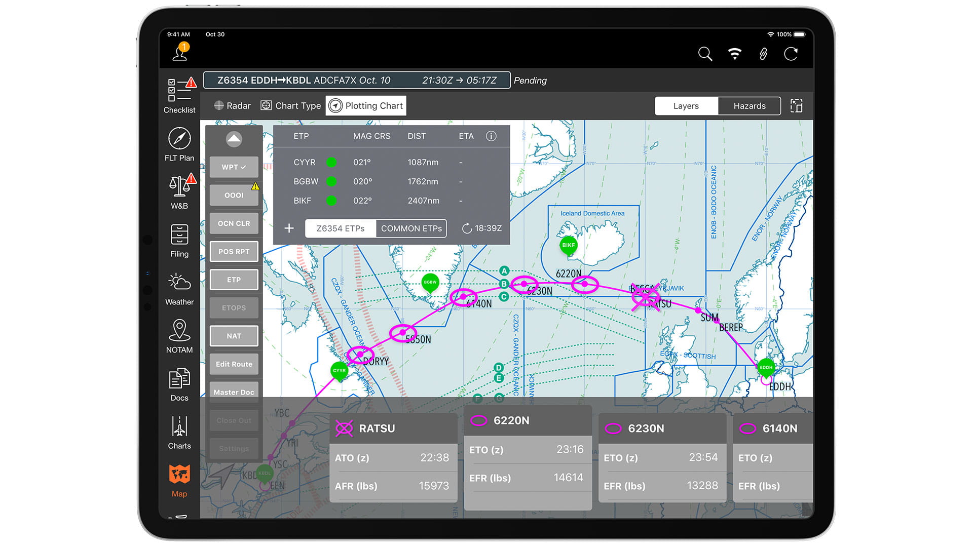
A pilot's best friend, the acclaimed ARINCDirect iPad app is designed for in-flight use by crew, with or without internet connectivity.
- Paperless oceanic plotting procedures
- Retrieve, adjust and file your flight plans
- Compute weight and balance calculations
- Sync leg, company, user and aircraft documents
- Access interactive aeronautical charts
- Review graphical weather overlays
- Included with ARINCDirect flight planning subscription
Plotting chart

ARINCDirect Mini

Good news for pilots on the go! ARINCDirect users are now able to quickly access and manage their flight plans using the smartphone in their pocket. Available for both Apple® and Android™ devices.
- Recompute, adjust and file flight plans
- Update PIC, SIC and persons on board
- Access text weather and smart NOTAMs
- Track active flights
- Included with ARINCDirect flight planning subscription
Weight, balance and performance
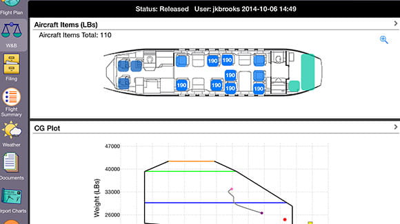
Collins Aerospace’s ARINCDirect offers runway analysis services, using software developed by Aircraft Performance Group (APG), combined with aircraft manufacturer supplied software, and performance data from the appropriate approved Airplane Flight Manual (AFM). With our runway analysis you can determine the maximum allowable gross weights for takeoff and landing procedures, for airports worldwide.
Fully integrated into the ARINCDirect flight planning tool, Weight & Balance (WB) reports are prepared using the customer’s specific aircraft interior configuration and take into account the precise location of all items on board.
Mapping and worldwide en route charts
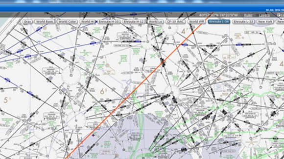
Collins Aerospace’s ARINCDirect offers customers a mapping feature with interactive planning capabilities, including worldwide mapping and navigation data. The application uses ARINC424 navigation data as well as National Aeronautical Charting Office (NACO) charts to provide worldwide mapping, simultaneously displaying multiple routes between city pairs.
Layers and features include:
- Flight information regions (FIRs)
- Animated radar
- Turbulence
- Icing
- Winds
- AIRMETs and SIGMETs
- Fuel stop locations
Weather services
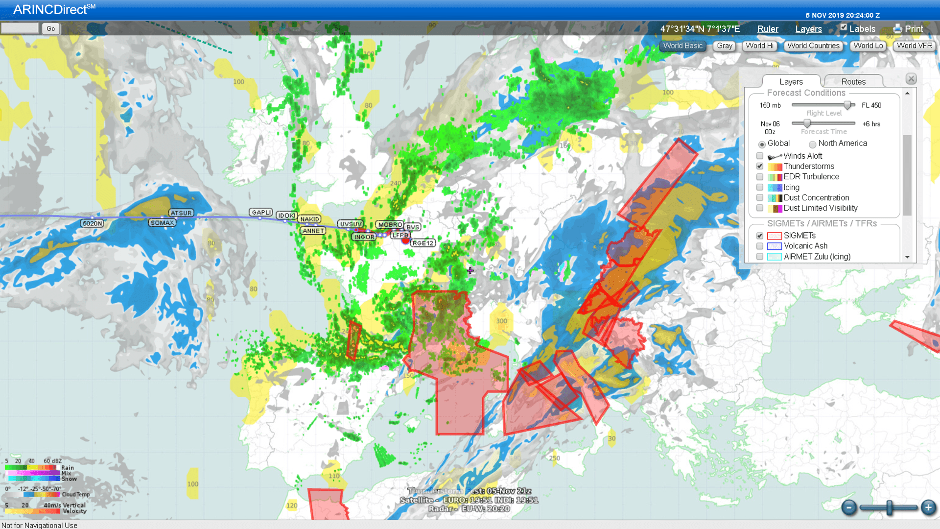
Collins Aerospace's ARINCDirect partners with DTN to provide the most detailed weather data anywhere, at any time – customized to meet operational preferences.
- Worldwide text weather, including METARs, TAFs, PIREPs, SIGMETs, AIRMETs and NOTAMs
- Worldwide web-based graphical weather charts
- Enhanced weather graphics for turbulence, icing and thunderstorms
- Worldwide radar (where available) and satellite imagery
- Area forecasts and route weather briefings
- Winds and temperatures aloft data
- Turbulence, convective activity and volcanic ash advisories
- "Plain language" weather briefs for passengers, including company logo
- Route of flight images with weather and TFR overlays
- Access to an aviation meteorologist for personalized weather briefings
Request information
I would like more information about this capability.
Contacts
ARINCDirect Services
Contact one of our account representatives for more information